Research Interests
Please see research group site at https://mnimorph.science/Please see C.V. at: https://www.philliphlarson.com/vitae.html
(for accomplishments referenced in this narrative,
please see Curriculum
Vitae):
From the very beginning of my academic career, I have
been driven by a deep commitment to advancing knowledge
through research. I believe research is a core
responsibility of our profession: to expand conceptual and
theoretical understanding for the benefit of society, to
serve communities through applied problem-solving, and, as
a Teaching Scholar (see Teaching),
to bring the most current theories, methods, and
discoveries into the classroom. In this way, research not
only advances science but also enriches teaching and
empowers students to engage with the world’s most pressing
environmental challenges.
Over the past 12 years at Minnesota State, I have worked
to pursue research through these three lenses of purpose,
founding and now co-directing the EARTH Systems Laboratory
(Earth science, Archaeology, Resources, Terrestrial
Hazards) to support collaborative research in natural
resources, hazards, geoarchaeology, environmental/climatic
change, and landscape dynamics. Today, my research focuses
on how dynamic landscape processes shape hazards, water
resources, and physical geography, and how these processes
are altered by climate variability and human activity.
This integrative approach formulated by my early career
research in Arizona has expanded through more recent work
in the upper Midwest and beyond.
Foundations in Arizona: Rivers and Slopes
Much of my early research centered on understanding
the Physical Geography of Arizona and this continues to
inspire and inform my current work. With colleagues, I
investigated the origin and evolution of major river
systems such as the Salt and Verde Rivers. This work
provided new insights into the establishment of the rivers
and the origin of their underlying aquifers, critical to
understanding water resources essential to growing
population centers like the Phoenix Metropolitan area. I
also examined mountain-front erosional processes,
including the evolution of pediments and bounding
hillslopes. These landscapes are directly relevant to
flash flooding and mass wasting hazards, especially as
urban development expands into steeper terrain.
Collectively, this work has been published in journals
like Annals of the American Association of
Geographers, Physical Geography, Progress in Physical
Geography, Geomorphology, among others. I also
served as Lead Editor for a comprehensive special issue in
the journal Geomorphology that not only details the
processes that resulted in the rivers and water resources
in central Arizona but also explains much of the
fundamental Physical Geography of Arizona, as well.
This Arizona-based research established the conceptual
foundation and methodological toolkit—including
field-based methodologies and proficiency with geospatial
technologies —that I continue to apply to my research.
Natural Hazards: Landslides and Catastrophic Flooding
Over the past 12 years, I have fundamentally connected
and expanded on the research themes pursued in Arizona to
establish both theoretical and applied projects in the
upper Midwest, USA, and elsewhere. My ongoing work with
colleagues and students has resulted in the first-ever
landslide inventory and susceptibility map in the state of
Minnesota – a region previously unrecognized for landslide
hazard risk but has experienced multiple fatal events in
recent years. This work is published both in a
peer-reviewed journal and with the United States
Geological Survey. More work is needed and ongoing
research is focused on identifying the driving mechanisms
of slope failure, which are increasingly influenced by
climate change and the resulting shifts in precipitation
patterns in Minnesota. These efforts are moving toward
predictive models of landslide occurrence and have clear
applied value for local, state and federal agencies tasked
with hazard mitigation. My colleagues at the University of
Minnesota and USGS and I are preparing a collaborative
grant proposal to further this work.
National Science Foundation-funded research is also
looking at the nationally publicized failure of the
Rapidan Dam along the Blue Earth River, Minnesota. Within
a few months of this event, several other dams failed
across the U.S.A. in similar fashion. We proposed the term
“avulsive dam failure” and in this work, colleagues,
students and I are investigating the failure process and
ongoing change to the Blue Earth River system as the river
adjusts to a new normal. The longitudinal profile
evolution of the river in response to the failure was
observed to be similar to natural basin integration
processes like those studied in Arizona rivers in my prior
work. The results of this work will allow for a better
understanding of risk posed by aging dam infrastructure
across the country and assist local, state, and federal
agencies with management of rivers following dam
failure.
Another National Science Foundation-funded research
project is investigating catastrophic flooding during
deglacial transitions, with a focus on paleolake outburst
events. Prior work by students and I hypothesized a
linkage between these processes and drainage integration
processes in Arizona that result in the establishment of
drainage networks and river systems. Our ongoing work is
utilizing field (ground penetrating radar, geochronologic
samples) and remote (LiDAR, satellite imagery) data from
both the Lake Superior basin and Glacial Lake Missoula
basin (Montana) to reconstruct past events and improve
conceptual and process-models of how and why these floods
occur. These studies are directly relevant to high alpine
landscapes worldwide, where modern glacial retreat and
meltwater lake formation pose growing hazards for
downstream communities. Importantly, these catastrophic
floods also reshape landscapes, creating dramatic relief
that primes valley margins for subsequent landslides. The
landslides I have studied in Minnesota are a direct result
of these processes. This linkage brings my work “full
circle”: the same processes that create landscapes and
establish river systems also generate the conditions for
modern landslide hazards. This integrated understanding of
landscape evolution is central to my research pursuits.
Climate and Water Resources: Linking Past and Present
A core thread throughout my research has been
understanding how river and hillslopes evolve in response
to climate variability through time. Work by my
collaborators and I on rivers in Arizona reveals how basin
spillover processes established these river systems and
transformed the landscapes through which they now flow.
Our current hypothesis is that these basin spillover
events may have been driven by past climatic variability.
Similar processes operate today in deglacial landscapes,
such as those in the upper Midwest, where climate-driven
meltwater lakes accumulated and eventually breached their
basins, resulting in high-magnitude discharge events that
fundamentally transformed landscapes into what we observe
in our modern Physical Geography. By connecting ancient
and modern systems, my work links theoretical
understanding with practical hazard assessment to create a
holistic picture tying landscape dynamics to climatic
change, both past and present.
Land Use and Anthropogenic Change: Human Impact on
Natural Systems
Most recently, my research has expanded to address how
human activities amplify or alter natural processes. My
prior work has focused on understanding natural systems
and how climate has impacted those systems. However, in
the upper Midwest, it has become abundantly clear that
both modern anthropogenic climate change and agricultural
land use have dramatically transformed hillslopes and
river systems. This has lead to widespread EPA-designated
impaired waters, biodiversity loss, and increased flood
and erosion risks. Given my prior and ongoing work on
river and hillslope systems, I felt compelled to
contribute by attempting to understand the magnitude of
anthropogenic influence and to assist in understanding how
things are changing.
With my colleagues and students, we have compared modern
erosion rates under intensive agricultural land use with
those during the late glacial period. This research
highlights how current human-driven erosion can rival or
exceed rates associated with past natural system behavior.
Both current and prior graduate students (see “Graduate
Students Supervised” in Curriculum Vitae) are producing or
have produced theses focused on changing hydrologic and
erosion/sediment deposition regimes in regional fluvial
systems, as well. Yet another student investigated the
efficacy of mitigation structures installed in
agriculturally dominated landscapes that were meant
mitigate nutrient loads and discharge from the uplands.
Recently, we have also compiled historic channel geometry
data from multiple regional rivers in Minnesota to
quantify how river planform patterns and processes evolve
over time with current work approaching a new mechanistic
model of channel width change. These insights are
essential for managing rivers impacted by anthropogenic
activity in a way that balances ecological health, hazard
mitigation, and human behaviors. This work has direct
implications for addressing environmental quality issues
in my home region and could be applied to land use and
climate-driven challenges in Arizona and the broader
Southwest or further afield.
For more information on the work my students, colleagues, and I are doing, please see:
https://www.philliphlarson.com/vitae.html
--------------------------------------------------------------------------------------------------------------------
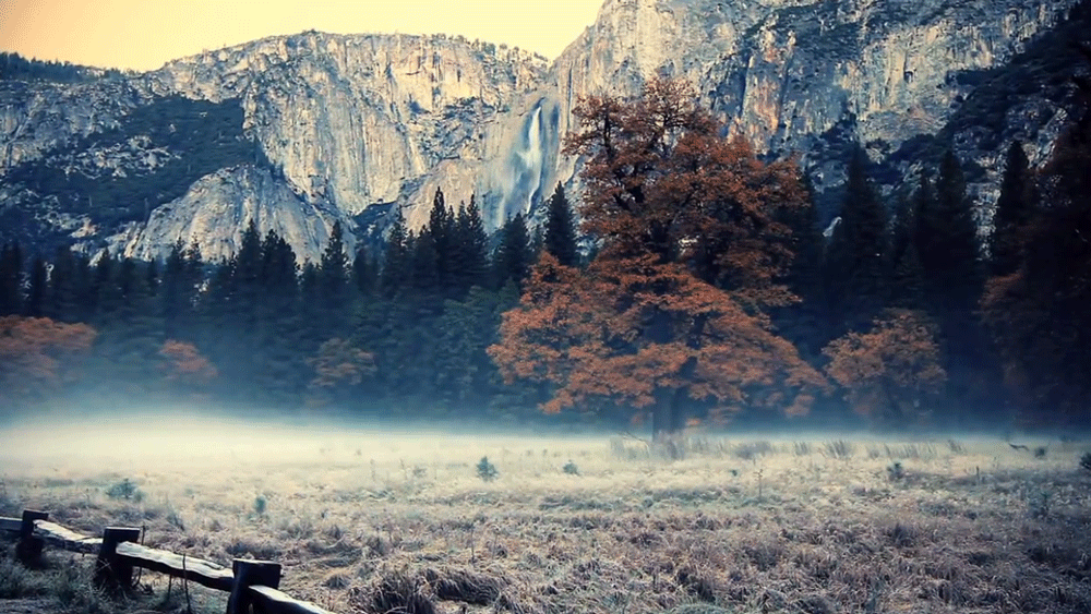
“Yosemite Valley,
to me, is always a sunrise, a glitter of green and
golden wonder in a vast edifice of stone and space.” - A. Adams